The Enigma Of Malta’s Prehistoric Cart Ruts
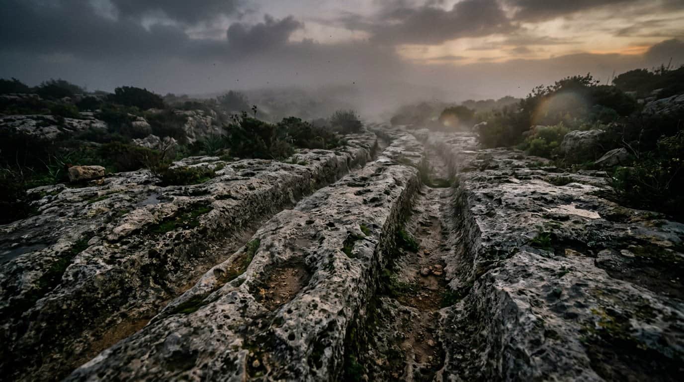
Across the sun-drenched islands of Malta and Gozo, a strange network of deep grooves scars the ancient limestone. Known as the mystery of Malta ruts, these parallel tracks wind through the hills like a prehistoric railway system frozen in stone. Some of these channels plunge two feet deep into the bedrock, trailing across the islands in over 150 distinct sets. They defy simple explanation, appearing in remote fields and busy plateaus alike, leaving historians to wonder who carved them and why.
The most famous site, nicknamed Clapham Junction, features a dizzying maze of intersecting lines that resemble a modern train yard. Perhaps the most chilling detail is that several tracks lead directly to the edges of high cliffs, disappearing into the Mediterranean Sea as if the land itself changed around them. Whether these ruts served as ancient irrigation, industrial transport, or something far more unusual remains one of the world’s most enduring archaeological puzzles. Every turn in the stone suggests a story of a lost civilization that moved mountains before vanishing into history.
Key Takeaways
- The ‘cart ruts’ of Malta and Gozo consist of over 150 sets of parallel limestone grooves that exhibit a standardized gauge of 110 to 140 centimeters, suggesting a sophisticated and coordinated engineering system.
- Evidence of ancient repairs, such as stone wedges found in the Attard excavations, indicates these tracks were actively maintained and served as a vital, long-term infrastructure for the island’s inhabitants.
- The fact that numerous tracks lead directly off cliffs or continue deep underwater suggests they were created thousands of years ago, before rising sea levels and geological shifts reshaped the Mediterranean coastline.
- While theories range from industrial transport for temple building to irrigation or ritual use, the lack of traditional wheel or hoof marks leaves the true technological origin of these deep channels an unsolved archaeological mystery.
Exploring The Stone Maze At Clapham Junction
Misraħ Għar il-Kbir stands as the most staggering example of Malta’s ancient engineering puzzles, earning the nickname Clapham Junction due to its resemblance to a complex railway hub. Here, dozens of deep limestone furrows crisscross the landscape in a chaotic yet deliberate pattern that defies easy explanation. Some of these tracks run perfectly parallel for long distances, while others curve sharply or intersect in ways that suggest a highly organized transport system. Visitors often feel as though they are walking through a prehistoric transit station where the ghosts of an unknown industry once thrived. The sheer density of these grooves in one location makes it the ultimate laboratory for those trying to decode the island’s distant past.
The technical precision of these ruts is what truly captures the imagination of researchers and history enthusiasts alike. Archaeologist David Trump noted that the standardized gauge between the tracks remains remarkably consistent, usually measuring between 110 and 140 centimeters. This uniformity suggests that whatever moved through these channels was built to a specific standard, much like modern trains or wagons. However, the mystery deepens when the tracks suddenly disappear over the edges of cliffs or plunge directly into the Mediterranean Sea. These strange dead ends hint at a time when the geography of the islands was vastly different, perhaps dating back to a period before rising sea levels reshaped the coastline.
While mainstream theories suggest the ruts were used for transporting heavy stones or soil during the Temple Period, the lack of traditional wheel marks or animal hoof prints leaves the door open for more creative possibilities. Some observers wonder if the tracks were part of a sophisticated irrigation system or even a form of ancient power generation technology that has since been lost to time. The deep U-shaped grooves, sometimes reaching 60 centimeters into the bedrock, show signs of immense pressure and long term use. As you stand among these weathered stone paths, it is hard not to wonder what kind of incredible machinery or sleds once slid through these channels. What do you think was the primary purpose of this massive stone network?
Vanishing Tracks And Underwater Archaeological Anomalies
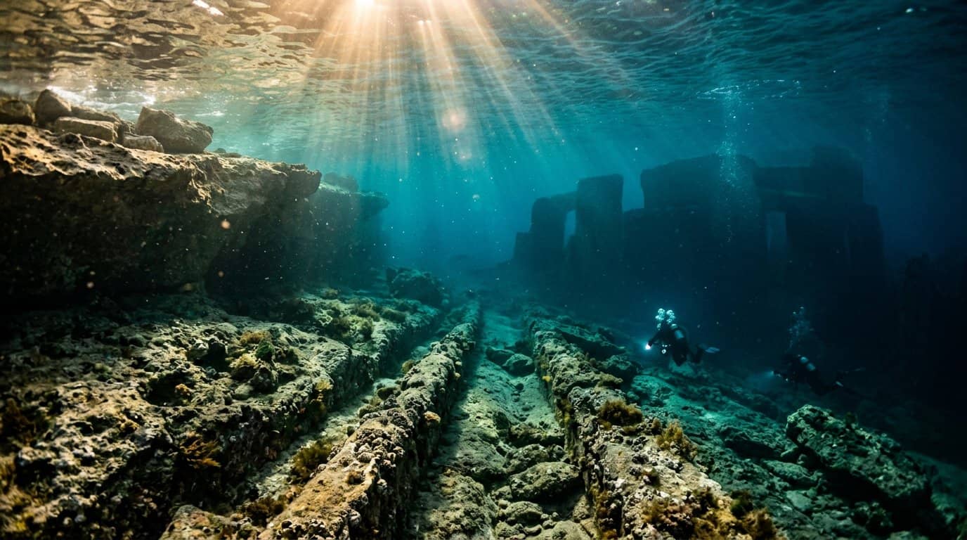
The most chilling aspect of the Maltese ruts is their complete disregard for the current environment, as many tracks lead directly to the edge of sheer cliffs. At sites like the Dingli Cliffs, these ancient grooves do not stop or turn, but simply vanish into the open air above the Mediterranean Sea. This suggests that the geography of the islands was vastly different when the tracks were first carved into the stone. If the land once extended much further, it would push the date of their creation back thousands of years to a time when sea levels were significantly lower. This geographical mismatch challenges the traditional timeline of Mediterranean civilization and hints at a lost era of prehistoric activity.
Submerged evidence further deepens the mystery, with divers reporting similar parallel tracks continuing deep underwater off the coast of St. George’s Bay. These underwater anomalies indicate that the tracks were made long before the ice caps melted and flooded the Mediterranean basin. Archaeologist David Trump noted that the consistency of the gauge, usually between 110 and 140 centimeters, suggests a deliberate and standardized system of transport or engineering. However, the fact that they now sit beneath the waves implies they are remnants of a society that predates the known temple builders of Malta. This evidence forces us to reconsider whether these ruts are simple cart paths or part of a much older, more complex technological infrastructure.
The sheer scale of these vanishing tracks invites us to imagine a world far different from the one we see today. If these ruts were part of a massive industrial or ceremonial network, the people who built them possessed a level of organization that remains largely misunderstood. Scientists continue to debate whether the grooves were worn down by repeated use or intentionally cut into the bedrock for a specific purpose. As these stone paths disappear into the deep blue water, they leave behind a haunting question about what other secrets lie buried beneath the sea. What do you think happened to the people who carved these paths into the very bones of the island?
Ancient Repairs And Modern Discoveries In Attard
The landscape of Attard recently revealed a new chapter in the enduring mystery of the Maltese cart ruts during a 2024 excavation project. Workers uncovered a previously hidden stretch of parallel tracks that had been buried beneath layers of soil and modern debris for centuries. These grooves exhibit the same precise gauge seen at famous sites like Clapham Junction, yet their pristine condition offers a rare look at the original craftsmanship. This discovery confirms that the network of tracks was far more extensive than previously mapped, weaving through the heart of the island in a complex web of ancient infrastructure. The find has reignited the debate among archaeologists regarding whether these paths were part of a coordinated national transport system or something more symbolic.
What truly captured the attention of researchers in Attard was the presence of small stone wedges intentionally jammed into the limestone grooves. These stones appear to be ancient repairs, used by the original inhabitants to smooth out uneven patches or provide traction in areas where the rock had worn too deep. This evidence of active maintenance suggests that the ruts were not a one-time creation but were used and cared for over a significant period. Seeing these physical signs of human intervention makes the mystery feel much more personal and immediate. It challenges the idea that the tracks were merely accidental scars from sledges, pointing instead toward a deliberate and sustained engineering effort.
As we look at these ancient patches, we are forced to wonder what kind of heavy cargo required such a dedicated and well-maintained road system. The consistent width of the tracks across the island implies a standardized vehicle, yet no remains of such a machine have ever been found. Some researchers suggest these ruts could be linked to the massive temple-building era, while others believe they served a purpose we have yet to fully comprehend. The discovery in Attard reminds us that the answers are still waiting just beneath our feet. Do you think these stone wedges prove the ruts were a vital highway for a lost civilization, or could they be evidence of a more mysterious ritual process?
Debating The True Purpose Of The Limestone Grooves
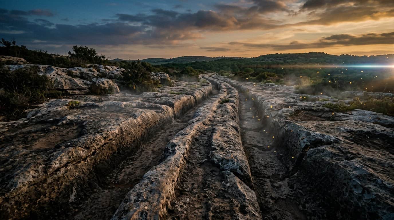
The most common explanation for these deep grooves suggests they served as a prehistoric transportation network for hauling heavy limestone. Archaeologists like David Trump have pointed out that the consistent gauge between the tracks mirrors the width of ancient sleds or wheeled carts. These vehicles, potentially weighed down by massive stone blocks used in temple construction, would have gradually worn down the soft limestone surface over centuries of use. This industrial transport theory treats the ruts as a functional byproduct of a highly organized society moving resources across the rugged Maltese landscape.
Alternative theories move away from transport and instead look toward the islands’ vital need for water management. Some researchers have proposed that the channels were part of an elaborate irrigation system designed to catch and direct scarce rainwater to agricultural fields. However, the way the tracks often climb steep hills or run straight off the edges of cliffs makes a simple water-flow explanation difficult to accept. This has led some curious minds to wonder if the grooves are actually remnants of lost civilization machinery or ancient geoglyphs that aligned with the stars.
The sheer precision and scale of the network at sites like Clapham Junction continue to fuel intense debate among both scientists and enthusiasts of ancient technology. While the transport theory remains the most grounded in archaeological evidence, it fails to explain why some tracks appear to lead nowhere or intersect in such chaotic patterns. Perhaps these ruts are the fingerprints of a civilization that possessed tools or methods we have yet to fully understand. Much like the builders of Göbekli Tepe, these ancient people achieved monumental engineering feats long before traditional timelines suggest it was possible. Do you think these grooves were the result of simple labor over thousands of years, or could they be evidence of a much more advanced ancient technology?
The Lingering Enigma of Malta’s Ancient Tracks
The mystery of the Malta ruts remains an open book that continues to challenge our understanding of ancient engineering. These massive stone scars etched into the limestone offer a silent testimony to a lost technology or a forgotten way of life. Whether they served as a sophisticated transportation network or a ritualistic pathway, the sheer consistency of their design suggests a high level of planning. The tracks at Clapham Junction still stand as a haunting puzzle, inviting anyone who walks among them to wonder about the hands that carved them.
Archaeologists and curious travelers alike are left to weigh the evidence of these deep, parallel grooves that often lead toward the sea or over steep cliffs. While some believe they were simple irrigation channels, others see the remnants of a massive prehistoric industrial site. The lack of clear tool marks or animal footprints only deepens the Enigma Of The Malta Cart Ruts surrounding their creation. This Mediterranean enigma proves that even in our modern age, the earth still holds secrets that science has yet to fully explain.
What do you think is the most likely origin for these ancient tracks? Perhaps they were part of a celestial calendar, or maybe they are the literal imprints of a technology we no longer recognize. We invite you to share your own theories and join the conversation about how these incredible markings came to be. Every perspective helps keep the investigation alive as we try to piece together the history of this remarkable island.
Frequently Asked Questions
1. What exactly are the Malta cart ruts?
These are deep, parallel grooves carved directly into the limestone bedrock of Malta and Gozo. They appear in over 150 sets across the islands and look like ancient tracks or a prehistoric railway system frozen in time.
2. Why is the site called Clapham Junction?
The site earned this nickname because the massive network of intersecting tracks looks just like a busy modern train yard. It is the most complex collection of ruts on the island, featuring lines that curve, cross, and run perfectly parallel for long distances.
3. How deep do these mysterious grooves go?
While some tracks are shallow, others plunge as deep as two feet into the solid stone. The precision of these channels suggests they were created by heavy, repeated use or intentional engineering by a lost civilization.
4. Is it true that some tracks lead into the ocean?
Yes, several sets of ruts run directly to the edges of high cliffs and disappear straight into the Mediterranean Sea. This suggests the geography has changed significantly since they were made, perhaps due to rising sea levels or shifting land masses.
5. What are the main theories about their purpose?
Researchers have suggested they served as irrigation channels, industrial transport systems, or tracks for heavy sledges. However, no single theory perfectly explains why they exist in such remote areas or why they intersect so chaotically.
6. Who built these ancient stone tracks?
The identity of the builders remains a mystery, though they are often linked to the temple building civilizations of Malta’s distant past. These people possessed the incredible skill to move massive stones and reshape the island’s rocky surface before vanishing from history.